Disrupting for Good: AI, ...
Online Conference
28 Jan 2026 / 29 Jan 2026 read more
Amira Nassar
Conference Coordinator
(+20) 3 5763827 | (+20) 3 5763828
(+20)1000028021
Subscribe to our newsletter
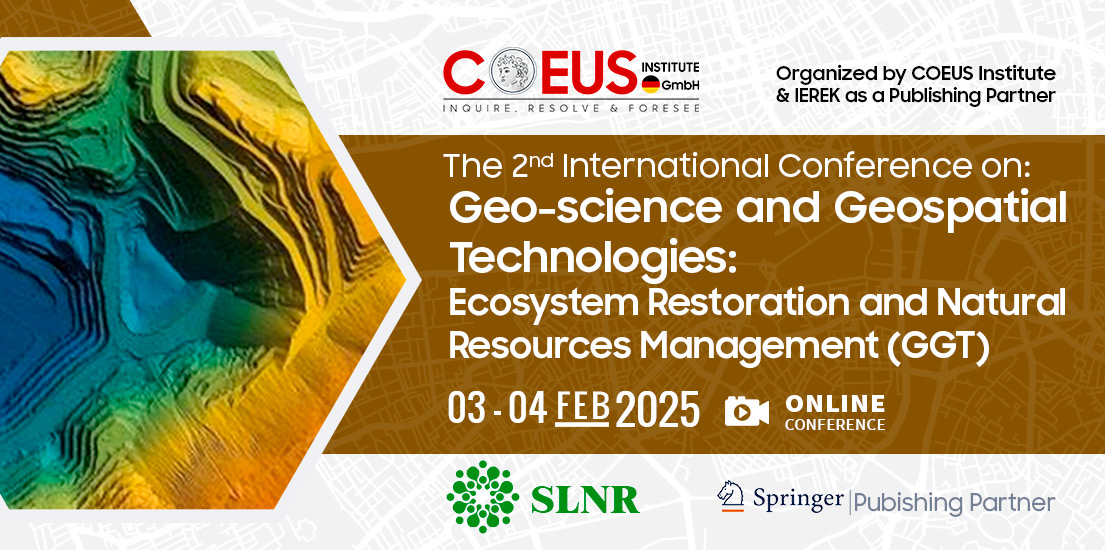
Earthquakes, volcanic eruptions, landslides, tsunamis, and countless natural disasters occur on a yearly basis. These natural disasters are all tied in a way to the field of geoscience. Geoscience is the study of processes that affect the Earth's surface, the natural resources that humans use, and the relationships between water and ecosystems. It encompasses much more than just rocks and volcanoes. Moreover, geoscience makes use of methods and resources from other scientific disciplines like chemistry, physics, biology, and math. In a rapidly evolving world characterized by dynamic environmental challenges, urbanization trends, and infrastructure demands, the need to gain an understanding of the power of geoscience and geospatial technologies has never been more obvious. Building upon the resounding success of the first conference, the “Geo-science and Geospatial Technologies: Earth Geosciences and Geotechnical Engineering” conference serves as a premier platform for multidisciplinary dialogue, knowledge exchange, and collaborative exploration at the intersection of geoscience, geospatial technologies, and geotechnical engineering, which summarizes the collective aspiration to foster synergy and collaboration across traditionally distinct disciplines.
The conference will handle topics such as geological hazards and how to avoid them, the processes of acquiring and assessing geospatial data, the investigation of geotechnical sites, groundwater exploration, and management, and the integration between geotechnical and geospatial technologies with the fields of engineering and urban planning. Attendees of the conference will have the chance to be a part of a platform that facilitates knowledge sharing and networking. The conference will address urgent issues with natural hazards, environmental monitoring, urban development, and geotechnical advances through interesting dialogue, innovative discoveries, and useful conversations about geospatial technologies. The conference will cover topics such as unleashing the power of satellite imagery and remote sensing technologies to monitor and analyze the Earth's surface, harnessing the potential of GIS in spatial analysis, mapping, and decision support systems for various applications, discussing the latest methods and tools for managing, analyzing, and visualizing geospatial data to derive meaningful insights. The conference will also examine how Geo-science and Geospatial Technologies contribute to monitoring and managing environmental changes, including climate change, land degradation, and natural resource conservation, explore how Geo-science and Geospatial Technologies enhance urban planning, transportation systems, and infrastructure development for sustainable and resilient cities.
The objectives of the conference include showcasing innovative applications of Geo-science and Geospatial Technologies in precision agriculture, forestry, water resource management, and biodiversity conservation, along with highlighting advanced modeling techniques and spatial analysis methods for understanding complex geospatial phenomena and predicting future trends. The second edition of our conference represents a gathering of esteemed scholars, researchers, industry pioneers, and innovators who share a common commitment to the advancing of knowledge and practice in critical domains. By uniting the expertise of geoscientists, geospatial technologists, and geotechnical engineers, the conference aims to catalyze transformative advancements in environmental management, urban planning, infrastructure resilience, and sustainable development.
1.1. Seismic Hazard Assessment and Earthquake Risk Mitigation
1.2. Landslide Susceptibility Mapping and Slope Stability Analysis
1.3. Fault Zone Characterization and Seismic Risk Zoning
1.4. Subsidence Monitoring and Ground Deformation Analysis
1.5. Hydrogeological Risk Assessment and Groundwater Contamination
1.6. Multi-Hazard Risk Assessment and Resilience Planning
2.1. LiDAR Technology and High-Resolution Terrain Mapping
2.2. Satellite Remote Sensing for Environmental Monitoring
2.3. Unmanned Aerial Vehicles (UAVs) for Geospatial Data Collection
2.4. Geospatial Big Data Analytics and Visualization
2.5. Geospatial Analysis for Natural Resource Management
2.6. Geospatial Data Standards and Interoperability
3.1. Geophysical Methods for Site Characterization
3.2. Cone Penetration Testing (CPT) and In Situ Soil Testing
3.3. Borehole Logging and Geotechnical Sampling Techniques
3.4. Geotechnical Mapping and Subsurface Modeling
3.5. Geotechnical Site Investigation for Infrastructure Projects
3.6. Geotechnical Characterization of Soft Soils and Problematic Ground
4.1. Hydrogeological Mapping and Aquifer Characterization
4.2. Climate Change Impacts on Groundwater Resources
4.3. Geophysical Methods for Groundwater Exploration
4.4. Groundwater Quality Assessment and Contaminant Transport
4.5. GIS-Based Decision Support Systems for Groundwater Management
4.6. Groundwater Resource Sustainability and Conjunctive Use
5.1. Remote Sensing Applications for Environmental Monitoring
5.2. Geospatial Analysis for Air Quality Monitoring and Pollution Mapping
5.3. GIS-Based Decision Support Systems for Environmental Impact Assessment
5.4. Geospatial Monitoring of Coastal and Marine Environments
5.5. Geospatial Analysis for Biodiversity Conservation and Ecological Monitoring
5.6. Citizen Science and Participatory Geospatial Monitoring
6.1. Geospatial Technologies for Infrastructure Resilience and Risk Mitigation
6.2. Geospatial Assessment of Ground Subsidence and Sinkhole Hazards
6.3. Geospatial Applications in Tsunami Hazard Assessment and Coastal Protection
6.4. Geospatial Monitoring of Coastal Erosion and Storm Surge Risks
6.5. Geospatial Analysis of Flood Hazards and Hydrological Risk
6.6 Community Resilience and Geospatial Risk Communication
7.1. GIS-Based Urban Land Use Planning and Zoning
7.2. Geospatial Analysis for Transportation Planning and Infrastructure Development
7.3. Smart City Planning and Geospatial Technologies
7.4. Urban Environmental Quality Assessment and Geospatial Monitoring
7.5. Geospatial Analysis for Urban Growth Management and Urban Sprawl Control
7.6. 3D Urban Modeling and Visualization for Urban Design and Development
8.1. Advanced Geotechnical Investigation Techniques for Complex Sites
8.2. Innovative Geotechnical Design Methods for Underground Structures
8.3. Geospatial Technologies for Geotechnical Data Collection and Analysis
8.4. Geotechnical Aspects of Sustainable Foundation Design and Construction
8.5. Geotechnical Challenges in Renewable Energy Infrastructure Development
8.6. Emerging Technologies in Geotechnical Monitoring and Instrumentation
| Title | Date |
|---|---|
| Short Paper Submission Deadline | 10 Jan 2025 |
| Notification of acceptance/ rejection of submitted extended abstract/ short paper | 15 Jan 2025 |
| Start Payment Date | 15 Sep 2024 |
| End Payment Date | 15 Jan 2025 |
| Conference Program | 15 Jan 2025 |
| Conference Launch | 03 Feb 2025 |
| Publication | Author | Co-author | Payment Deadline |
|---|---|---|---|
SLNR book by Springer |
200 € |
100 € |
10 Oct 2024 |
The fee covers:
Payment Methods:
Payment of the registration fee can be made via the following methods (only after online registration):
1. Bank transfer
Bank Account Name/ Beneficiary Name: COEUS INSTITUTE GMBH
Beneficiary (COEUS) Address: Simmlerstr. 17, 75172 Pforzheim, Germany
Bank Account (EUR): 5210755
Bank Name: Sparkasse Pforzheim Calw
IBAN: DE75 6665 0085 0005 2107 55
SWIFT/BIC: PZHSDE66XXX
Post Code: 75172
*** VAT is applied on some countries, please check the PDF HERE before payment ***
*** Please note that the transaction fee is solely the payee’s/ Remitter’s responsibility. The Beneficiary should receive the total amount specified above without deductions. Incomplete amounts may result in an outstanding amount and a request for completion***
*** After you have completed the payment, kindly inform us with full transaction details. The transaction will remain marked as pending until we receive confirmation. After you make your transfer, kindly send us a scanned copy of the receipt to [email protected] ***
2. Online payment gateway (Stripe)
Participants who would like to complete their payments online must send a request to the conference coordinator/ email and CC [email protected] to receive a customized electronic invoice to complete their payments.
Payment Terms and Guidelines:
This process can only be initiated after payment completion and confirmation:
All accepted submissions to the conference, after a rigorous double-blinded peer-review process by the respective and a highly-extinguished Editorial Board, will be published in:
 Sustainable Landscape Planning and Natural Resources Management (SLNR), an IEREK Interdisciplinary book series published by Springer Nature.
About SLNR
Sustainable Landscape Planning and Natural Resources Management (SLNR) is a peer-reviewed book series that presents groundbreaking research through the intersection of two main areas that of which are ‘Sustainable Landscape Planning’ and ‘Natural Resources Management’. The series initially covers a wide range of academic disciplines in sustainability, including landscape ecology, green urbanism, urban regeneration, land restoration and renaturation, energy management, and nature conservation. Moreover, it also incorporates the latest developments and research in engineering topics that contribute to more sustainable cities, such as Geosciences, infrastructure, civil engineering, geology, mining, water, and natural resources conservation and management.
By showcasing methods for discovering, managing, and employing natural resources, the series aims to provide approaches that enable the responsible use of these resources. Ultimately, the SLNR series is committed to advancing the United Nations' Sustainable Development Goals for 2030. Read More
Attending a conference dramatically enhances both your professional and personal development. They help you sharpen the saw, meet and converse with industry experts, expand your resources and grow your professional network. IEREK Conference will help you:
1. Open Discussions: We bring together leading academic scientists, from different universities and countries, to exchange and share their experiences and research results.
2. Internationally Accredited Certificate: The participants are granted internationally recognized certificates acknowledged by IEREK, and Partnering Organization.
3. Publication: Selected high-quality manuscripts will be published, after peer review, in the Advances in Science, Technology & Innovation (SLNR) book series by Springer
4. Research Technologies: Conferences can expand your resources by providing a great opportunity to promote gathered information on new technologies related to your research.
5. Networking: You can engage with industry experts to discuss with them the very latest research projects they could be working on and increase your chances of collaboration in future projects.
6. Academic Reputation: Attending many conferences will make you a known figure in academic circles and an active member of the academic community.
7. Conference Abstracts Material: Delegates will receive the conference Abstracts book in soft copy.

ORCID, which stands for Open Researcher and Contributor ID, is a global, not-for-profit organization that aims to provide unique identifiers for authors, researchers, and scholars. ORCiD effectively eliminates duplication and errors regarding author names, affiliations, previous works, and all related academic data.
IEREK is a proud member of ORCiD, and we contribute directly to their initiative of clear and identifiable markers for researchers and scholars. As the first Egyptian partner to ORCiD in the organization’s history, we strongly believe that by utilizing ORCiD’s database and verification services, we become one step closer to achieving an accurate, and identifiable academic landscape.
We encourage our authors to input their ORCiD ID when registering for one of our conferences, submitting an abstract, or a full paper. By doing so, you directly link your research to your identity and affiliation and can showcase your various academic efforts all in one place. By Registering your ORCiD ID, you also increase your works’ visibility and provide easy access to your entire library of research and academic activity.
Click here to learn more about ORCiD, and here to register your ORCiD ID for free.
Delegates in any event who cancel their registration due to special circumstances will receive refunds according to the following:
| Cancellation Policy | Up to 60 days before the event | 59 days before the event |
| Penalty | 20% | 100% |
A refund is not possible if
- An acceptance letter has been issued (Authors only)
- The proceedings of the event have been published (Authors only)
- A submitted manuscript is rejected by the editorial board after going through peer review.













Amira Nassar
Conference Coordinator
(+20) 3 5763827 | (+20) 3 5763828
(+20)1000028021
Subscribe to our newsletter
Join IEREK community